


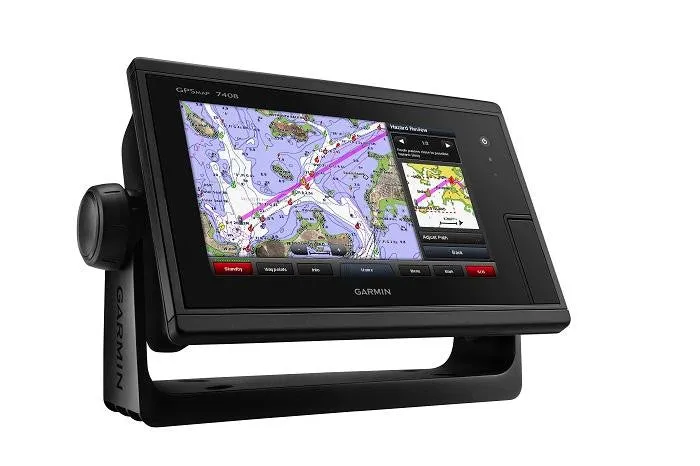
Garmin GPSMAP 7408 Chartplotter Worldwide Basemap
Model: 010-01305-10UPC: 753759158958
- 8-inch multi-touch widescreen display (1024 x 600 WSVGA)
- High-sensitivity internal 10 Hz GPS/GLONASS
- Fully network capable for Garmin Marine Network and NMEA 2000®, plus NMEA 0183 support
- Supports GSD™ premium sonar and GCV™ scanning sonar modules
- Advanced sailing and sail racing features
- J1939 connection provides a dedicated CAN port for receiving engine data.
Designed for cruisers, sailors and sailing racers who demand high performance, ease of operation and feature integration, the GPSMAP 7408 chartplotter with 7-inch multi-touch widescreen display has a 10 Hz internal GPS that updates position and heading 10 times per second. It is fully network capable, including the Garmin Network and NMEA 2000, and offers the conveniences of built-in Wi-Fi® connectivity.
Garmin Marine Network and NMEA 2000 SupportFull-network compatibility allows you to add more capabilities to your boat. GPSMAP 7408 supports radar, autopilot, instruments, multiple screens, FUSION-Link, sensors, remote sonar modules, digital switching, thermal cameras, GRID rotary knob, joystick and keypad control, GXM™ 52 Marine Weather receiver and more.
Add Array or Dome RadarYou can add your choice of Garmin marine radar, including our powerful Xhd2 open array radars or Xhd dome radars that pairs ease of use with advanced open array features.
Network SharingGPSMAP 7408 allows you to share features with other compatible GPSMAP units, such as radar, GCV 10 DownVü and SideVü scanning sonar, GSD 24, GSD 25 and GSD 26 sonar modules, supplemental maps, and user data, including waypoints, routes and tracks. User data entered into 1 chartplotter can be automatically synced with other chartplotters in a network.
Heading and Position Refreshed 10 Times Per SecondFast, responsive 10 Hz GPS/GLONASS refreshes your position and heading 10 times each second to make your movement on the screen more fluid. It makes dropping up to 5,000 accurate waypoints — and finding your way back to them — quick and easy.
Special Sailing FeaturesSupported sailing features include laylines, enhanced wind rose, heading and course-over-ground lines, true wind data fields and tide/current/time slider. Gauge displays are designed to provide important need-to-know information at a glance, including true and apparent wind angle, set and drift, true or apparent wind speed, horizontal or vertical graphs, and a data bar with customizable data fields.
Compatible with gWind™ TransducersGarmin gWind, gWind Wireless and gWind Race transducers feature twin-fin technology with 3-bladed propeller. Connect to the NMEA 2000 and compatible Garmin chartplotters via the GND™ 10 black box bridge.
Black Box InterfaceThe GND 10 black box interface seamlessly integrates Nexus instruments and sensors with the Garmin family. It converts data between the Nexus network and NMEA 2000 to provide trouble-free compatibility between Nexus and Garmin products.
Upgrade with the Best Maps on the WaterTwo microSD™ card slots provide expandable memory for accessory map purchases, such as LakeVü HD Ultra with Max Def Lakes or BlueChart g2 Vision that add Garmin patented Auto Guidance and other great features.
FUSION-Link Entertainment SystemEnjoy the ability to control all compatible FUSION-Link-enabled audio systems directly from your compatible chartplotter display.
Built-in Wi-Fi/ANT ™Built-in Wi-Fi/ANT for use with Garmin Helm™ and BlueChart Mobile.
View and Control Your Device from a Smartphone or TabletGarmin Helm allows you to view and control your compatible Garmin chartplotter from a compatible smartphone or tablet while providing enhanced situational awareness for the mariner. Easily switch between portrait and landscape mode to accommodate mounting preferences. When using an iPhone® or iPad®, you can even record a movie of your chartplotter screen to share with friends and family. Download from The App Store™ or Google Play™.
Get Your Apple® Device Onboard with BlueChart MobileWith BlueChart Mobile, a free app downloaded from the App Store, you can plan marine routes on your iPad or iPhone then wirelessly transfer them to your boat’s compatible networked Garmin chartplotter. Even if you don’t have a Garmin chartplotter, you can still take advantage of the tremendous features of BlueChart on your Apple device.
Specifications| Physical Performance | |
| Waterproof | IPX7 |
| Weight | 3.1lbs |
| Receiver | 10 Hz GPS/GLONASS |
| Antenna | Internal or external over NMEA 2000 |
| Mounting options | Bail, flat or flush |
| Display Size | 7.0"" x 4.0""; 8.0"" diagonal |
| Display resolution | 1024 x 600 |
| Display Type | WSVGA |
| Maps & Memory | |
| Preloaded Maps | None |
| Accepts data cards | 2 SD™ cards |
| Waypoints | 5,000 |
| Routes | 100 |
| Track Log | 50,000 points; 50 saved tracks |
| Features & Benefits | |
| Garmin radar compatible | Yes |
| Garmin Sonar compatible | Yes (when connected to another compatible sonar device) |
| NMEA 2000® compatible | Yes |
| NMEA 0183 compatible | Yes |
| Garmin SmartMode compatible (customizable monitor presets) | Yes |
| Supports AIS (tracks target ships position) | Yes |
| Supports DSC (displays position data from DSC-capable VHF radio) | Yes |
| Tide tables | Yes |
| Garmin Meteor Audio System compatible | Yes |
| Supports Fusion-Link compatible marine radios | Yes |
| GSD™ Black Box sonar support | Yes |
| GCV™ Black Box sonar support | Yes |
| SiriusXM™ Weather & Radio compatible | Yes |
| BlueChart® Mobile (planning) compatible | Yes |
| Garmin Helm compatible | Yes |
| GRID™ (Garmin Remote Input Device) compatible | Yes |
| Wireless remote compatible | Yes |
| Wireless mouse compatible | No |
| Sonar Features and Specifications | |
| Dual-frequency (50/200 kHz) sonar capable | Yes (when connected to another compatible sonar device) |
| Dual-beam (77/200 kHz) sonar capable | Yes (when connected to another compatible sonar device) |
| CHIRP sonar technology | Yes (when connected to another compatible sonar device) |
| DownVü™ | Yes (when connected to another compatible sonar device) |
| SideVü™ | Yes (when connected to another compatible sonar device) |
| Connections | |
| NMEA 0183 input ports | 2 |
| NMEA 0183 output ports | 2 |
| Video input ports | 1 Composite |
| Video output ports | None |
| Wireless connectivity | Yes |
| Garmin Marine Network™ ports | 2 |
| Additional Features | |
| User Interface | Multi-touch touchscreen |
| Auto backlight dimming | Yes |
| Supplemental map sharing | Yes |
| Internals sonar sharing | Yes, receive only |
| Input Voltage | 10-30Vdc |
| Input Draw | Max power usage at 10 Vdc: 27 W Typical current draw at 12 Vdc: 1.8 A Max current draw at 12 Vdc: 2.3 A Typical current draw at 12 Vdc: 1.5 A Max current draw at 12 Vdc: 2.0 A |
| Dimensions | 9.6? x 6.3? x 3.0? (24.4 x 16.0 x 7.6 cm) |
What's in the Box:
- GPSMAP 7408 with worldwide basemap
- Power/data cable
- NMEA 2000® drop cable
- T-connector
- Bail mount with knobs
- Flush mount kit
- Protective cover
- Documentation


 BackPack 64GB Card Card Reader More")
